This blogpost outlines some of the different clay characteristics across Denmark. The national geological investigations for Denmark and Greenland, GEUS, fairly well describe the distribution of clays in Denmark. Furthermore perspectives to other countries in particular Norway is made ensuring a variety of phenomena is covered.
- The soil map of Denmark
- Distribution of clays
- Clays in Denmark
- Hydrology and boulder clay
- Types of geotechnical analyses
- Clay and perspectives
- Conclusion
- References
The soil map of Denmark
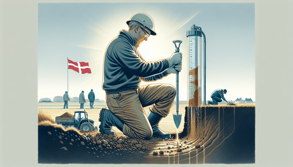
Since the year 1888, GEUS has continuously worked on the development of a geological map with high resolution over the entire underground in Denmark and certain parts of Greenland. Utilizing soil spears every 100-200 meters with a depth of 1 meter, GEUS has produced information about the underground and in particular the upper soil layers helping a variety of industry with demand of soil knowledge. Furthermore it is made available to the general public free of charge!
To develop the map, GEUS utilize newer sources and more detailed earth characteristic samples such as detailed borings, geotechnical samples, and excavations. The information of these comes from other projects and are kindly utilized for creating the soil map.
Essentially, the general public can access the map in a variety of formats online. In this blogpost we look into the scale 1:200,000 while there exists a scale 1:25,000 online. In this blogpost I have decided to include the coarse resolution one, see Figure 1.

Earth types and distribution
The soil map details and encapsulates earth types without providing detailed analysis such as Atterberg limits, drained and undrained friction values for sands, and similar geotechnical analysis. To access such information, one would need to examine the variety of soil profiles and analyses available in the Jupiter database, referenced with link in the references.
Related read: The Atterberg limits: History, evolution and perspectives, Natural materials – clay, Understanding Triaxial Test: Soil Strength in All Directions
The map clearly shows that brown boulder clay is the most abundant soil type found in the upper Danish underground. It also highlights how the ice ages influenced the distribution of sands and clays, particularly in the western part of Jutland, where distinct areas of sandy soil and coarse-grained material from retreating glaciers remain.
This analysis provides a high-level qualitative insight from the map. Additionally, we can readily observe that Jutland has a more complex soil composition with greater variety than the two islands, Zealand and Fynen.
Accuracy and reliability of the soil map of Denmark
In reality, although the map looks like it is complete with information it is actually, to some extent, an interpretation of information from older sources and unreliable data. This means that in particular areas in the middle of Jutland are at risk of misinterpretation leading to uncertainties in the displayed information.
GEUS presents an illustrative figure in Figure 1, showcasing the extent of the generally charted areas based on their presumed methodology of conducting 1-meter deep coverage across approximately 100×100 meters. They mark the figure with areas that are charted in green, uncharted in blank, and under development in blue. Figure 2 outlines a copy of the original figure, highlighting the various individual areas.

Discussion of accuracy
Figure 2 above shows large blank areas in the middle of Jutland, and to some extent, in Fyn and the northwestern part of Jutland across the Limfjord.
Although these areas remain mostly blank, resulting from interpreted data from earlier days, borings in nearby areas, and similar sources, you should regard the general extent and content of the soil map showcased in Figure 1 as fairly accurate and definitively representative of the Danish underground. Thus, you can use it to examine the different distributions of soil types within the upper layers of the Danish underground.
Distribution of clays
The distribution of clays across the Danish underground and their differences are a complex product of the load history arising from changing ice ages and geological activity to mention a few of the processes which soils undergo.
Furthermore, evidence shows that large habitats for ancient vertebrates contributed to the development of chalk as their skeletons compressed over millions of years. This process influences the formation of rock in clay deposits, a topic I briefly discuss in the related read below.
Related read: How does clay formation affect rock?
This is also one of the key characteristics when looking for oils beneath the underground.
Clays in Denmark
There exist a variety of multiple clay types in Denmark which all have different properties compared to one another. The most abundant is boulder clay as this consists of both clay and boulders in a mixture where the different grain size are readily apparent.
There also exist finer type of till clays which have a narrower (steeper) grain size distribution. This means that the properties varies greatly compared to other types of clay especially in relation to the interactions with water and strength characteristics which is mostly reliant on the water interaction properties.
One could say that in general the interaction with water is one of the key defining characteristics of clay types in general across all of geotechnics. Now with all this talk of clay what is it exactly used for one might ask.
Use cases of clay
Clay is used for pottery, mineral production, beauty products, production of building materials and agriculture to mention a few.
In short clays are a uniquely complex earth type whose use cases span wide and deep. if you want to read more about the fundamental clay characteristics consider the posts below.
Relevant reads: Natural materials – silt, Soil characteristics – sand
Clay types
Clay types in Denmark range from fine till clays, characterized by a very fine grain size distribution without large stones, gravel, or similar materials embedded in the media, to coarser boulder clay. The underlying material of boulder clay is clay; however, it contains multiple embedded stones and gravel-like material meaning that it stands out as a particular type of soil. Let’s dive in deeper with what exactly is boulder clay.
Fun Fact: The easiest way to identify whether there is talking about clay or silt is a simple test with your teeth where you place a small quantity of the soil you are investigating between your teeth and grind. If the soil makes noises due to inherently containing minuscule grains then it is a silt, otherwise if it is smooth and soft then it is a clay.
Boulder clay in Denmark
The boulder clay in Denmark, is called in Danish “Moræneler” and in English, boulder clay. This clay type is the most abundant in the Danish underground. This clay type is special in the sense that it produces a clay which contains a variety of grain sizes meaning that it has quite a characteristic geotechnical strength and long term swelling phenomena might also occur if continually exposed to water. The typical grain size distribution for Copenhagen boulder clay is outlined in Figure 3.

A rough estimate is that approximately 60 % of all Danish clays are boulder clays according to the Jupiter database, see references for more info. This means that the understanding of the grain size distribution and how cracks are forming throughout the medium for boulder clay has a variety of important use cases.
Some of these include the hydrogeological features of the soil which might come into play during contamination cases or environmental impacts of chemical compounds traveling with the water flowing through the media.
Hydrology and boulder clay
Clay’s hydrological features resemble those of a cork in a wine bottle, effectively acting as a barrier that prevents water from passing through.
Water naturally transports nutrients, particles, chemical compounds, and various types of matter, making its movement crucial. This becomes especially significant in areas housing drinking water sources, where controlling water flows and mitigating contamination risks from hazardous chemicals is essential. Clay aids in understanding how underground water flows through aquifers, as clay layers serve as ‘closed doors’ for the water or liquid involved.
Given that clay is nearly impermeable to water, it is vital to explore how cracks and leaks develop within the boulder clay medium. This represents just one critical aspect; numerous empirical measurements help characterize soil parameters, as strength can vary significantly across different spatial fields.
Types of geotechnical analyses
The geotechnical analysis used to characterize soils varies in type, cost, and equipment. Some common measurement techniques include Casagrande tests, Atterberg limits, consolidation tests, triaxial testing, rotating spear tests, standard penetration tests, cone penetration tests, plate load tests, and permeability tests. This list is not exhaustive but highlights the most commonly performed tests worldwide.
The choice of tests depends on the specific project being developed. For large projects, such as apartment complexes, engineers often conduct multiple geotechnical analyses to adequately assess soil strength. Typical tests for these projects include SPT, triaxial tests, CPT, and load-bearing tests.
Conversely for small building projects such as single family houses, it might be sufficient to perform a rotating spear test and maybe Casagrande test for a boulder clay formation.
Clay and perspectives
A common trait for clays is the general grain size and their ability to adhere, absorb and uphold water.
The distinct interactions with water alongside with the grain size distribution of clay, or rather the lack of a proper grain size distribution is key when trying to understand clay and how the physio-chemical properties differ from silts and sands in particular.
Clay behavior
A noteworthy observation reveals that a relatively small amount of clay, in relation to the percent finer, is necessary for the entire media to behave like clay. This occurs due to the influence of sub-micro-scale grain sizes on water interaction. When characterizing clay by its grain size distribution, it may only account for 10-15% of the mass, as illustrated in Figure 3; however, the presence of clay changes the behavior of the entire substance, facilitating more compact and rigorous material compaction.
The adherence to water and the ability to swell alongside with the drainage properties, makes clay one of the most fascinating geological substances that is readily available to a majority of the population.
Related read: Stabilizing the Leaning Tower of Pisa: Engineering Marvels
Now this was some words on the Danish underground and clay in general, however we are, so to say, just scratching the surface as the real distribution and abundance of clay types range incredible far compared to other branches of science. This means that we only have to look northward to Norway before stumbling into other incredible phenomena from clay.
Perspectives to Norway
In certain regions, such as Norway, specific types of clay exhibit remarkable behavior: when sheared, they transform into a nearly liquid state as the water trapped within the soil rapidly escapes. This swift change from a solid that can withstand high pressures to a loose, granular mass significantly triggers massive earth slides and natural disasters across the Norwegian shelf.
This situation puts local populations at risk, as they may suddenly find themselves in danger during rainy seasons, facing the threat of sudden earth slides that could sweep them away.
Quick clay
Norway has numerous examples of this troublesome quick clay. The hazardous characteristics of quick clay are particularly evident throughout the country, as its topography is conducive to catastrophic landslides during prolonged rainy weather. The country’s fiords are prime hotspots for the rapid saturation of soils, exacerbating the risk. For a visual representation of the distribution of common upper soil types across the Norwegian continent, please refer to Figure 4.

The Norwegian figure vividly illustrates a significantly more complex distribution of colors compared to the Danish underground. The impact of topology on soil distribution becomes clear, as fiords create more diverse coarse-grained areas than flat plains.
Inherent complexities
Clay presents incredible complexity, with properties that vary widely depending on its geographical location. Researchers still need to delve deeper into many soil phenomena to provide detailed explanations that could benefit various industries, including cosmetics and construction. I hope you find this blog post engaging! If you do, please leave a like or comment, and feel free to share the content in any way you prefer.
Conclusion
This blog post has explored the diverse clay characteristics found across Denmark, utilizing insights from the national geological investigations by GEUS. We examined the comprehensive soil map of Denmark, which reveals the intricate distribution of clay types, notably the prevalence of boulder clay. The influence of historical geological events, such as the ice ages, has played a significant role in shaping the present soil composition, particularly in regions like Jutland.
Additionally, we discussed the implications of clay’s properties, including its interactions with water and its role in various industries such as construction and agriculture. The analysis encompassed various geotechnical methodologies for studying soil, emphasizing the importance of reliable data for effective land use.
Furthermore, the post briefly contrasted Denmark’s clay characteristics with those in Norway, particularly highlighting the phenomenon of quick clay and its potential hazards. This comparison underscores the complexities inherent in clay behavior and the need for ongoing research to fully understand its implications within different geographical contexts.
Overall, this investigation into Danish clays not only enhances our understanding of local geology but also sets the stage for further exploration of the interactions between soil types and environmental factors, ultimately contributing to better land management practices and industry applications.
References
Knowledge regarding soil map: www.miljoeogressourcer.dk – Geo-vejledning 2018/01.
Jupiter database: https://www.geus.dk/produkter-ydelser-og-faciliteter/data-og-kort/national-boringsdatabase-jupiter
Grain size distribution of boulder clay: https://commons.m.wikimedia.org/wiki/File:Gsd-ml.jpg#mw-jump-to-license


Leave a comment